
John Agar
Managing Director
Service
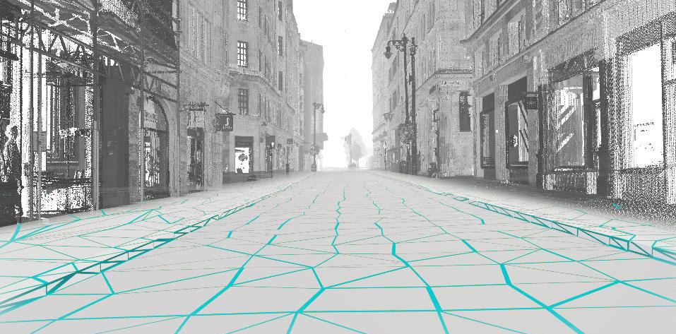
The measurement and capture of topographic, terrain and boundary detail forms the bedrock of MSA’s services and is usually the fundamental starting point from which most development progresses.
The topographic survey captures and records the topography of the ground surface together with both natural and man-made features within the built environment. It is intended to provide the accurate extents and location of a site, site buildings as well as a good understanding of the levels, physical features, boundaries and drainage in the adjacent area.
Topographic surveys have traditionally been produced in a 2D format, however, we understand that providing this information in a 3D format greatly improves the design accuracy by providing coherent and integrated solutions which deliver considerable cost savings.
MSA offers a wide range of surveys aimed at the detection, location and verification of buried and underground service utilities, all in accordance with the latest BSI standards “PAS 128 – Specification for Underground Utility Detection” and The Survey Association (TSA) guidance notes.
Working alongside our topographic survey team, we use Electro-Magnetic Location (EML) and Ground Penetrating Radar (GPR) techniques to deliver reliable and comprehensive layouts of underground utility apparatus which, when combined with written reports and photography, provide an invaluable resource.
With land such a valuable resource, particularly in densely populated environments, it is essential for property owners and developers to have a clear understanding of their sites constraints.
A measured boundary survey is therefore intended to do exactly that and to identify key physical boundary elements. Boundary details such as walls, fences, buildings, hedges are measured and compiled on plans that can be checked against Deeds, Land Registry Plans and Ordnance Survey Digital Data drawings. Such information is invaluable for a boundary expert and will be used to formulate recommendations and opinions when used in conjunction with the property Title Deeds or negotiated agreements.

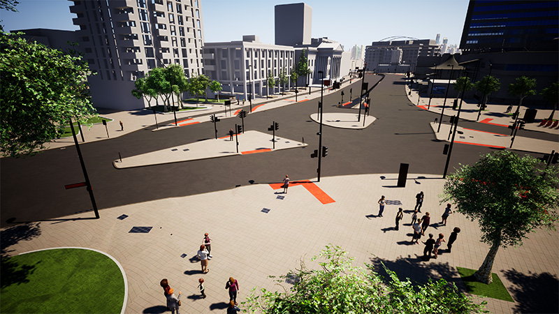
A digital terrain model (DTM) enables an accurate assessment of the profiles and contours of a site using surveyed field measurements to represent spatial elevation data in a graphical environment.
MSA’s extensive survey based experience has provided the backdrop to numerous terrain modelling projects including runway and taxiway ponding analysis, volumetric assessment of landfill sites and the provision of several accurate urban street models for pedestrian based improvements in Central London.
Accurate terrain and surface modelling reduces the uncertainty, improves the assessment of the bill of quantities and enhances the planning and engineering design of infrastructure projects.
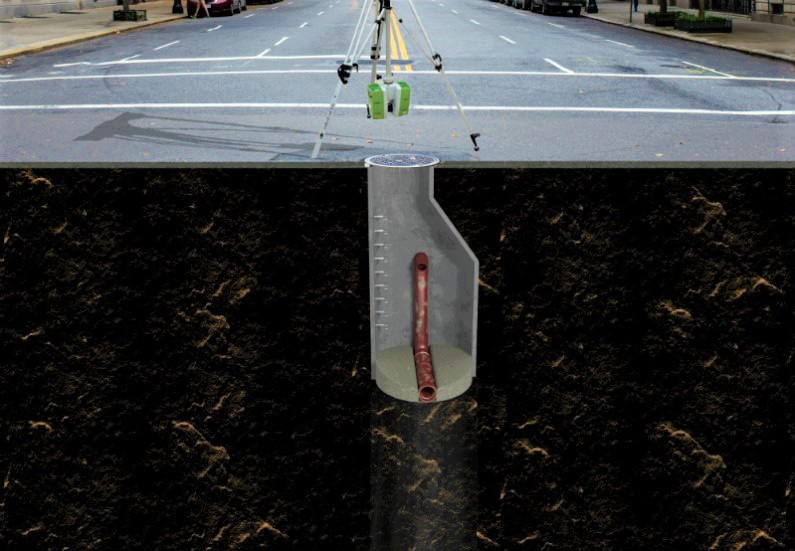
MSA is often requested to undertake a drainage investigation in conjunction with a topographic survey to provide a complete service. The intention is to provide a more accurate assessment of site drainage arrangements and to identify cover locations, drainage runs, pipe sizes and depths. This provides a more comprehensive site picture and clarifies how foul and storm water is managed on a property and how this then connects to adopted systems.
A CCTV survey is the quickest and most accurate way to establish a detailed understanding of the condition of underground drains and pipework. The approach is entirely non-intrusive and early detection of underlying problems can prevent costly damage.
The information supplied is used to detect blockages or defects that can result in structural damage to property or impact on continued site operations. An effective CCTV investigation provides certainty and can prevent the cost and inconvenience of invasive intervention needed to resolve a fault.
The resultant imagery when used in conjunction with other drainage investigations provides an accurate picture of current arrangement and conditions. This informs development design and is essential when undertaking a due diligence exercise for a property.
We set ourselves apart by applying objective and unconventional thinking to look beyond old habits and traditional measurement tools.
Fast turn-around of measured information gives you the edge in a highly competitive market
Comprehensive information capture provides a reliable project foundation your team can rely upon.
We can extract data quickly from scans without returning to site, minimising time, cost and disruption.
Capture of all site detail, from floorspace and ceiling heights to the number of telephone sockets and light fittings.
Make swift, informed decisions with our visual reports, photography, 3D models and plans.
We optimise financial return with solutions that meet tight timescales and budget requirements.
Memberships & Certifications
Team
Our passion, commitment and aptitude gives us a consistently progressive and creative approach to measurement.
Services

3D building models, digital twins, plans and reports to determine key structural and architectural elements, areas and layouts

The science of measurement and achievable tolerances makes us an invaluable partner for your engineering requirements.

Our highly accurate state-of-the-art laser and photographic equipment produce cross-platform models and photo tours.

Comprehensive and accurate 3D high definition (HD) scanning is at the core of all our services.
Memberships & Certifications